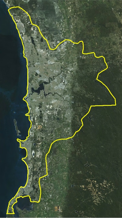
The delivery of the Perth metro LiDAR has started to trickle in to Landgate, with the final delivery of the raw (unclassified data) due by 31 Aug. Shortly after we will receive the classified and derivative outputs (contours, DEMs and building footprints). The data will be available as a minimum of 12PPM in both GDA94 and 2020 formats
Landgate is now in receipt of the raw .las point clouds for the Perth metro - extent below - GDA94 only at this stage.
We are yet to receive the classified .las data, DEM, contours and vector products for the entire extent, but they are trickling in slowly. FYI -The vector products comprise of permeable (buildings, roads) and impermeable surfaces.
For further information, please refer to LiDAR Data - Landgate
Landgate has taken receipt of all the classified LiDAR point cloud data over the entire capture area - in GDA94 - in 1sqkm tiles.
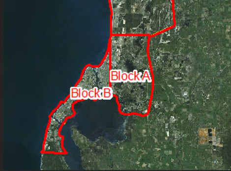
We also have the contour datasets covering the entire area and the vectors (building, veg, etc) for Blocks A & B only - in GDA94 only at this stage.
More information will be provided as it comes to hand.
Landgate are now in receipt of the classified .las files as well as the derivative products (DEMS, contours) for both GDA94 and GDA2020.
In terms of the raw LiDAR ,we have the GDA94 only at this stage.